[VIDEO] Severe convective storm meteorology & hail risk mapping
About this installment in VDE Americas' tech talk series

Who is presenting?
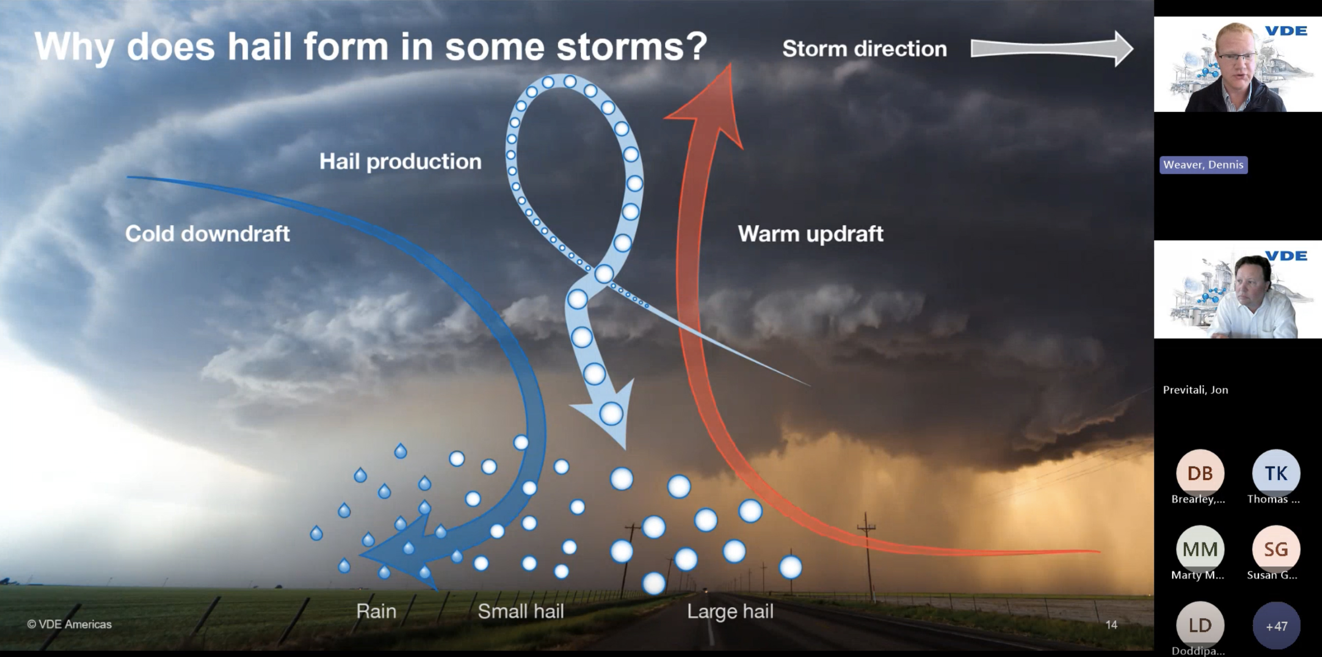
In this webinar, Dennis Weaver, staff meteorologist for VDE Americas, explains hail formation and growth in convective thunderstorms, summarizes how climate scientists expect hail frequency and size to change in future climate scenarios, and demonstrates how to use advanced ArcGIS maps to characterize site-specific hail risk based on project location and fielded technology. Prior to this on hail meteorology and mapping, Jon Previtali, vice president and senior principal engineer for VDE Americas, reviews catastrophic solar hail loss events in the continental United States, important meteorological and financial risk metrics, and the technical advisory's Hail Risk Intelligence.
What will you learn about?
- Severe convective storm dynamics
- Principals of hail formation and growth
- El Niño and La Niña impacts on hailstorms
- Hail meteorology in future climate scenarios
- Geographic information system (GIS) software
- Population bias in traditional hail risk maps
- Return intervals for naturally occurring hail
- Probable maximum / average annual loss metrics
- ArcGIS-based hail risk meteorology maps
- ArcGIS-based financial risk exposure maps
Watch this video on demand to learn how VDE's Hail Risk Intelligence and Hail Risk Atlas empower solar project stakeholders to better protect critical energy assets, ensuring sustainable investment returns, insurable assets, and a worthwhile future.

